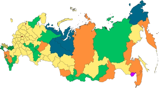
Republic of Karelia
A Russian republic with ancient geology and extensive waterways.

The Republic of Karelia, also known as Karelia or Karjala, is a republic of Russia located in the northwestern part of the country. It was founded as an autonomous republic within the Russian SFSR in 1923, replacing the Karelians Labour Commune, and from 1940 to 1956 it was known as the Karelo-Finnish Soviet Socialist Republic. It covers an area of 172,400 square kilometers and has a population of 533,121 residents, with its capital at Petrozavodsk. The republic is significant for its ancient geology, vast forests, and numerous lakes and rivers, as well as its role in the Northern Dimension project for international cooperation.
- established
- 27 June 1923 (as autonomous republic within Russian SFSR)
- area
- 172,400 km²
- population
- 533,121 residents
- capital
- Petrozavodsk
- highest_point
- Nuorunen peak at 576 m
- largest_lakes
- Lake Ladoga and Lake Onega
Lore & Background
The Republic of Karelia is situated in northwestern Russia, between Lake Ladoga and the White Sea, sharing borders with Murmansk, Arkhangelsk, Vologda, and Leningrad Oblasts, as well as Finland. Its geology is part of the Fennoscandian Shield's ancient Karelian craton, with Archaean and Paleoproterozoic rocks up to 3.4 billion years old, making it the largest contiguous Archaean outcrop in Europe. The republic contains about 27,000 rivers and 61,000 lakes, including Europe's largest lakes, Ladoga and Onega, and its forests cover 85% of the territory, holding 807 million cubic meters of timber.
Reader's Guide
The Republic of Karelia holds significance as a region with a distinct Karelian ethnic identity, reflected in its name derived from the Karelians. Its history includes periods as an autonomous republic and as the Karelo-Finnish Soviet Socialist Republic, before reverting to autonomous status in 1956 and remaining part of Russia after the Soviet Union's dissolution in 1991. The republic's natural resources—including iron ore, diamonds, vanadium, and molybdenum—and its extensive forests contribute to its economic importance. Its participation in the Northern Dimension project highlights its role in international cooperation, particularly with Finland, Sweden, Norway, and other regions. The ancient geology and numerous waterways make it a notable area for scientific study and tourism.
Did You Know?
- The Republic of Karelia's highest point is the Nuorunen peak at 576 meters.
- It contains 61,000 lakes, including Lake Ladoga and Lake Onega, the largest lakes in Europe.
- The republic's surficial geology includes rocks dated up to 3.4 billion years in the Vodlozero block.
- From 1940 to 1956, it was known as the Karelo-Finnish Soviet Socialist Republic.
Geography & Natural Boundaries
Karelia is a vast stretch of Northern European land running from the White Sea coast in the north all the way down to the Gulf of Finland in the south. Two of Europe's largest lakes, Ladoga and Onega, sit within its borders, while the Karelian Isthmus wedges between the Gulf and Lake Ladoga. The region's highest point, Nuorunen, rises to 576 metres on the Russian side of the Maanselkä hill region. Historically, natural waterways defined Karelia's edges: the River Kymi marked the western boundary between Karelians and the Häme Finns during the Middle Ages, possibly even serving as a cultural divide as far back as the Bronze Age. The Svir River on the far side of Lake Ladoga is traditionally regarded as the southern limit, while Lake Onega and the White Sea form the eastern edge. To the north, the nomadic Sami inhabited the land, with only dense taiga forests and open tundra serving as natural barriers. The border with Ingria, home to the closely related Ingrian people, originally followed the Neva River before shifting northward to the Sestra River, which today lies within the Saint Petersburg metropolitan area.
The Tangled Web of Treaties and Borders
Karelia's political boundaries have been redrawn repeatedly across centuries. The Treaty of Nöteborg in 1323 first split the region between Sweden and the Novgorod Republic, with Sweden taking the southern Karelian Isthmus and most of South Karelia, while Novgorod claimed the northern isthmus, North Karelia, and Ladoga Karelia. The Treaty of Stolbovo in 1617 shifted large portions of Russian Karelia to Swedish control, but this provoked a mass exodus of thousands of Karelians, including the ancestors of today's Tver Karelians, who fled into Russia. Subsequent agreements continued to reshape the map: the Treaty of Nystad in 1721 returned a portion to Imperial Russia, and the Treaty of Åbo in 1743 ceded South Karelia as well. After the Finnish War, these ceded provinces, known as Old Finland, were folded into the Grand Duchy of Finland in 1812. The Winter War of 1939–40 then stripped Finland of the eastern, chiefly Lutheran part of historical Karelia, which was ceded to Russia.
Deep Roots: Early Inhabitation
Archaeological evidence paints a picture of Karelia as a region of deep and growing human settlement. During the Early Middle Ages, settlers arriving from western Finland blended with the local population to form the Karelian ethnic group, though possible migration from other directions may also have shaped this community. The densest traces of early habitation cluster along the western shore of Lake Ladoga and the Karelian Isthmus, where multiple cemeteries and other finds date from roughly AD 600 to AD 800. In South Karelia, the number of discoveries from that window is smaller, yet permanent settlement was clearly established; the village of Lappee, for instance, has been continuously inhabited for approximately two thousand years. North Karelia yielded only a single find from that early period, an eighth-century discovery. However, the considerably higher number of archaeological finds from AD 800 to AD 1050 across these regions strongly suggests that the Karelian population was growing and expanding rapidly during those centuries, spreading its footprint well beyond the initial coastal and lakeshore settlements.
A Name, Many Faces: Cultural Identity
The very name Karelia carries layers of linguistic and religious identity. In Finnish and Karelian it is Karjala, in Russian Kareliya (historically Korela), and in Swedish Karelen. The region is split between two distinct cultural spheres: the Republic of Karelia on the Russian side, home to a chiefly Russian Orthodox population, and the Finnish regions of South Karelia, North Karelia, and the eastern part of Kymenlaakso, which are chiefly Lutheran. Within Finland, Karjala specifically refers to South and North Karelia, though parts of the historical province also extend into North Savo and South Savo. The inhabited localities bear multiple names reflecting this bilingual heritage: Petrozavodsk is also known as Petroskoi or, during 1941–1944, Äänislinna; Vyborg carries the Finnish Viipuri and Swedish Viborg; and Kostomukša is called Kostamus in Karelian. Even the sub-regions carry their own labels—Ladoga Karelia, Border Karelia, White Karelia, Olonets Karelia, and Tver Karelia—each marking a distinct slice of a shared but deeply divided cultural landscape.
Frequently Asked Questions
What is the Republic of Karelia?
Karelia (also called Karjala) is a Russian republic situated in the country's northwestern corner, with Petrozavodsk serving as its capital. It is home to roughly 533,000 people spread across 172,400 square kilometres of forested, lake-dotted terrain.
How did Karelia come to exist as a republic?
It was established on 27 June 1923 as an autonomous republic inside the Russian SFSR, taking over from the earlier Karelians Labour Commune. Between 1940 and 1956 it carried the name Karelo-Finnish Soviet Socialist Republic before reverting to its current status.
What makes Karelia's landscape stand out?
The region is defined by remarkably ancient geology, dense boreal forests, and an extraordinary density of lakes and rivers. Its highest point, Nuorunen peak, rises to just 576 metres, while two of Russia's largest lakes—Ladoga and Onega—anchor its waterways.
Why do fans and geographers consider Karelia important?
Its vast, pristine waterways and old geological formations make it a key reference point for studies of the Northern Dimension and Russian environmental heritage. It also carries a layered political history that illustrates how Soviet-era borders and identities shifted over the twentieth century.
What is Karelia's capital and how big is the republic?
Petrozavodsk is the administrative centre, sitting on the shores of Lake Onega. The republic covers 172,400 km², making it one of the larger subnational units in Russia despite its modest population of about 533 thousand.
More in Russian Regions 1-24
Elsewhere in the Russian Regions universe
Spotted an error? Know more?
This is a living reference — every entry is fact-audited, and reader corrections feed straight into our audit queue. Suggest an edit · See this site's audit record