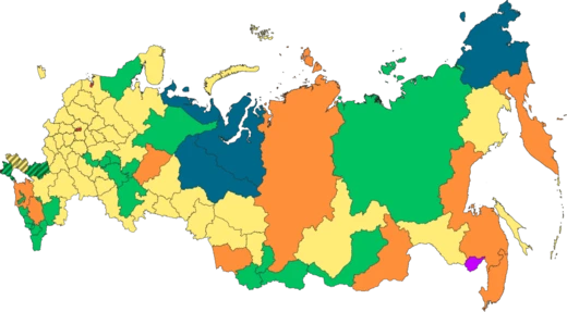
Sverdlovsk Oblast
Industrial heartland of Russia and site of the Romanov execution.

Sverdlovsk Oblast is a region of Russia, classified as an oblast, and belongs to the Ural Federal District. Its capital is Yekaterinburg, a city once called Sverdlovsk. According to the 2021 Census, the oblast is home to 4,268,998 people.
The oblast’s terrain is largely made up of the eastern slopes of the Middle and North Urals, along with the Western Siberian Plain. Only its southwestern part extends onto the western slopes of the Ural Mountains. The highest peaks are in the North Urals: Konzhakovsky Kamen reaches 1,569 meters, and Denezhkin Kamen stands at 1,492 meters. The Middle Urals are mostly hilly, with no clear peaks and an average elevation of 300 to 500 meters. Major rivers include the Tavda, Tura, Chusovaya, and Ufa, with the last two feeding into the Kama. Moving clockwise from the west, the oblast borders Perm Krai, the Komi Republic, Khanty–Mansi Autonomous Okrug, Tyumen Oblast, Kurgan Oblast, Chelyabinsk Oblast, and the Republic of Bashkortostan. A line of equal latitude and longitude cuts across the area from northeast to southwest.
The region is rich in natural resources, especially metals like iron, copper, gold, and platinum, as well as minerals such as asbestos, gemstones, and talcum, plus marble and coal. Much of Russia’s 18th- and 19th-century industry was concentrated here.
The climate is continental, with long, cold winters—average temperatures on the Western Siberian Plain range from −15 °C to −25 °C—and short, warm summers. Only in the southeast do July temperatures reach +30 °C.
People have lived in this territory since ancient times. Archaeological sites from the Paleolithic through the Iron Age have been found, including the Garinsky site on the Sosva River near Gari, the Shaitansky grotto site, and the Bezymyanny cave site (dating to the 10th millennium BC). The Shigir idol, discovered in 1890, is about 11,000 years old, from the Mesolithic period. On the right bank of the Iset River, the Kalmatsky Brod tract contains a settlement and burial ground from the Sarmatian era (3rd century BC to 2nd century AD), linked to the Kalmak culture. Skulls there show signs of tight bandaging in early childhood, pointing to steppe ethnic groups moving north. Pictograms appear on the Koptelovsky stone, Oblique stone, Two-eyed stone, and at Starichnaya and Serginskaya. Bronze Age rock paintings exist along the Neyva and Tagil Rivers, and c
- Population (2021 Census)
- 4,268,998
- Administrative Center
- Yekaterinburg (formerly Sverdlovsk)
- Highest Point
- Konzhakovsky Kamen (1,569 m)
- Major Rivers
- Tavda, Tura, Chusovaya, Ufa
- Key Natural Resources
- Iron, copper, gold, platinum, asbestos, gemstones, coal
Lore & Background
Sverdlovsk Oblast lies mostly on the eastern slopes of the Middle and North Urals and the Western Siberian Plain. Its highest mountains are Konzhakovsky Kamen at 1,569 meters and Denezhkin Kamen at 1,492 meters. The region is rich in natural resources, especially metals like iron, copper, gold, and platinum, as well as minerals such as asbestos and gemstones. During the 18th and 19th centuries, the bulk of Russian industry was concentrated here, driven by the Demidov family's control of Ural mines and the founding of ironworks at Yekaterinburg, Nevyansk, and Tagil.
Reader's Guide
Sverdlovsk Oblast holds a central place in Russian history due to its industrial might and pivotal events. In the 18th and 19th centuries, it became the core of Russian metallurgy, with factory towns enjoying special autonomy. The region was also the site of the execution of Tsar Nicholas II and his family by local Bolsheviks on 17 July 1918. During the Soviet era, forced labor built many industrial enterprises, and World War II saw production facilities relocated here from European Russia. The oblast later led the 'Urals Five' in a 1993 attempt to form a 'Ural Republic,' which was dissolved by President Boris Yeltsin. Its demographic composition is predominantly Russian (90.6%), with significant Tatar, Ukrainian, and Bashkir minorities.
Did You Know?
- The Shigir idol, discovered in 1890, dates to the Mesolithic period, about 11,000 years old.
- The American U-2 spy plane pilot Gary Powers was shot down over Sverdlovsk on 1 May 1960.
- In 1979, an anthrax outbreak occurred due to an accident at a biological weapons facility in the oblast.
- The oblast attempted to form a 'Ural Republic' in 1993, which was dissolved by President Yeltsin after 10 days.
Frequently Asked Questions
What is Sverdlovsk Oblast?
Sverdlovsk Oblast is a federal subject of Russia located in the Ural Federal District, with Yekaterinburg as its administrative center. As of the 2021 Census, roughly 4.27 million people call it home.
Why was the oblast called Sverdlovsk?
The region's capital was officially named Sverdlovsk in honor of Yakov Sverdlov, the early Soviet leader, before being restored to its original name, Yekaterinburg, in 1991. The oblast itself kept the Sverdlovsk name as a nod to that era.
What makes Sverdlovsk Oblast's geography stand out?
The territory straddles the eastern flanks of the Middle and North Urals and stretches into the Western Siberian Plain, with its southwestern tip touching the mountains' western slopes. Its highest summits—Konzhakovsky Kamen at 1,569 m and Denezhkin Kamen at 1,492 m—sit in the North Urals, while rivers like the Tavda, Tura, Chusovaya, and Ufa carve through the landscape.
What natural resources is Sverdlovsk Oblast known for?
The oblast's Urals geology yields a remarkable mix of iron, copper, gold, platinum, asbestos, gemstones, and coal. This mineral wealth has long underpinned its reputation as one of Russia's core industrial regions.
Why is Sverdlovsk Oblast historically significant?
Beyond being a pillar of Russian heavy industry, the region is the site where the last Romanov imperial family was executed in 1918, an event that marks a definitive end to Russian monarchy. That combination of industrial might and revolutionary history gives the oblast a uniquely layered place in the national narrative.
More in Russian Regions 1-24
Elsewhere in the Russian Regions universe
Spotted an error? Know more?
This is a living reference — every entry is fact-audited, and reader corrections feed straight into our audit queue. Suggest an edit · See this site's audit record